Datei:Eesti keila vald.png
Zur Navigation springen
Zur Suche springen

Größe dieser Vorschau: 800 × 532 Pixel. Weitere Auflösungen: 320 × 213 Pixel | 640 × 426 Pixel | 1.024 × 682 Pixel | 1.280 × 852 Pixel | 2.500 × 1.664 Pixel
Originaldatei (2.500 × 1.664 Pixel, Dateigröße: 120 KB, MIME-Typ: image/png)
![]()
Diese Datei und die Informationen unter dem roten Trennstrich werden aus dem zentralen Medienarchiv Wikimedia Commons eingebunden.
![]()
Beschreibung
| Beschreibung |
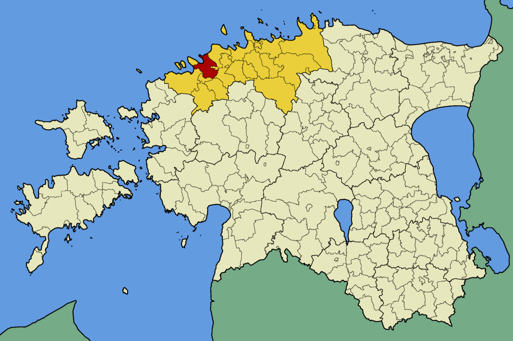
English: Map of Estonia with borders of municipalities (parishes). Harju county and Keila municipality (parish) emphasized. |
| Datum | |
| Quelle | Eigenes Werk |
| Urheber | Mmh |
Lizenz
Ich, der Urheberrechtsinhaber dieses Werkes, veröffentliche es hiermit unter der folgenden Lizenz:
Diese Datei ist unter der Creative-Commons-Lizenz „Namensnennung – Weitergabe unter gleichen Bedingungen 3.0 nicht portiert“ lizenziert.
- Dieses Werk darf von dir
- verbreitet werden – vervielfältigt, verbreitet und öffentlich zugänglich gemacht werden
- neu zusammengestellt werden – abgewandelt und bearbeitet werden
- Zu den folgenden Bedingungen:
- Namensnennung – Du musst angemessene Urheber- und Rechteangaben machen, einen Link zur Lizenz beifügen und angeben, ob Änderungen vorgenommen wurden. Diese Angaben dürfen in jeder angemessenen Art und Weise gemacht werden, allerdings nicht so, dass der Eindruck entsteht, der Lizenzgeber unterstütze gerade dich oder deine Nutzung besonders.
- Weitergabe unter gleichen Bedingungen – Wenn du das Material wiedermischst, transformierst oder darauf aufbaust, musst du deine Beiträge unter der gleichen oder einer kompatiblen Lizenz wie das Original verbreiten.

|
Es ist erlaubt, die Datei unter den Bedingungen der GNU-Lizenz für freie Dokumentation, Version 1.2 oder einer späteren Version, veröffentlicht von der Free Software Foundation, zu kopieren, zu verbreiten und/oder zu modifizieren; es gibt keine unveränderlichen Abschnitte, keinen vorderen und keinen hinteren Umschlagtext.
Der vollständige Text der Lizenz ist im Kapitel GNU-Lizenz für freie Dokumentation verfügbar. |
Du darfst es unter einer der obigen Lizenzen deiner Wahl verwenden.
Dateiversionen
Klicke auf einen Zeitpunkt, um diese Version zu laden.
| Version vom | Vorschaubild | Maße | Benutzer | Kommentar | |
|---|---|---|---|---|---|
| aktuell | 17:11, 16. Mär. 2015 | | 2.500 × 1.664 (120 KB) | Kruusamägi | update |
| 00:22, 23. Okt. 2013 |  | 2.500 × 1.664 (241 KB) | Flying Saucer | correction | |
| 02:21, 21. Okt. 2013 |  | 2.500 × 1.664 (241 KB) | Flying Saucer | update | |
| 00:07, 10. Nov. 2009 |  | 2.500 × 1.664 (83 KB) | Mmh | The border between the municipalities of Torgu and Salme (Saare county) corrected. | |
| 20:17, 29. Okt. 2009 |  | 2.500 × 1.664 (83 KB) | Mmh | {{Information |Description={{en|1=Map of Estonia with borders of municipalities (parishes). Harju county and Keila municipality (parish) emphasized.}} |Source={{own}} |Author=Mmh |Date=2009-10-29 |Permission= |other_versions= }} [[Category:L |
Dateiverwendung
Die folgende Seite verwendet diese Datei:
Globale Dateiverwendung
Die nachfolgenden anderen Wikis verwenden diese Datei:
- Verwendung auf be.wikipedia.org
- Verwendung auf cs.wikipedia.org
- Verwendung auf en.wikipedia.org
- Verwendung auf es.wikipedia.org
- Verwendung auf et.wikipedia.org
- Verwendung auf fa.wikipedia.org
- Verwendung auf fy.wikipedia.org
- Verwendung auf hy.wikipedia.org
- Verwendung auf it.wikipedia.org
- Verwendung auf ka.wikipedia.org
- Verwendung auf ms.wikipedia.org
- Verwendung auf nl.wikipedia.org
- Verwendung auf no.wikipedia.org
- Verwendung auf sco.wikipedia.org
- Verwendung auf sv.wikipedia.org
- Verwendung auf uk.wikipedia.org
- Verwendung auf www.wikidata.org
- Verwendung auf zh-min-nan.wikipedia.org
- Verwendung auf zh.wikipedia.org