Datei:Ghana districts.png
Zur Navigation springen
Zur Suche springen
Größe dieser Vorschau: 412 × 599 Pixel. Weitere Auflösungen: 165 × 240 Pixel | 330 × 480 Pixel | 684 × 995 Pixel
Originaldatei (684 × 995 Pixel, Dateigröße: 27 KB, MIME-Typ: image/png)
![]()
Diese Datei und die Informationen unter dem roten Trennstrich werden aus dem zentralen Medienarchiv Wikimedia Commons eingebunden.
![]()
Beschreibung
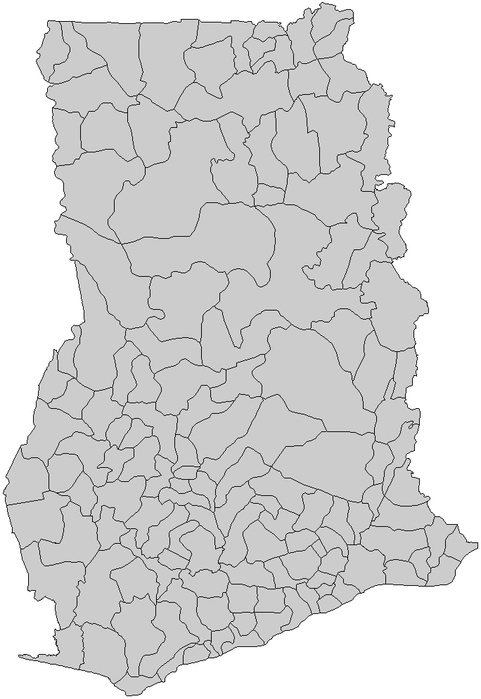
| Quelle | from en:Wikipedia, Districts of Ghana | ||
| Genehmigung (Weiternutzung dieser Datei) |
I, the creator of this work, hereby release it into the public domain. This applies worldwide. In case this is not legally possible, I grant any entity the right to use this work for any purpose, without any conditions, unless such conditions are required by law. |
||
| Georeferenzierung | If inappropriate please set warp_status = skip to hide. | ||
| Andere Versionen |
|

File history
Legend: (cur) = this is the current file, (del) = delete this old version, (rev) = revert to this old version. Click on date to download the file or see the image uploaded on that date.
   * (del) (cur) 06:47, 5 March 2006 . . Rarelibra (Talk | contribs) . . 816x1056 (30,638 bytes) (Map of the districts of Ghana. Created by Rarelibra for public domain use. Created using MapInfo Professional v7.5 and various mapping resources.)
   * Edit this file using an external application
Lizenz
| Ich, der Urheberrechtsinhaber dieses Werkes, veröffentliche es als gemeinfrei. Dies gilt weltweit. In manchen Staaten könnte dies rechtlich nicht möglich sein. Sofern dies der Fall ist: Ich gewähre jedem das bedingungslose Recht, dieses Werk für jedweden Zweck zu nutzen, es sei denn, Bedingungen sind gesetzlich erforderlich. |
derivative works
Abgeleitete Werke dieser Datei:
Dateiversionen
Klicke auf einen Zeitpunkt, um diese Version zu laden.
| Version vom | Vorschaubild | Maße | Benutzer | Kommentar | |
|---|---|---|---|---|---|
| aktuell | 23:09, 27. Nov. 2019 | | 684 × 995 (27 KB) | Aréat | Classic map, no need for colors. This show the limits, and there no enclave |
| 11:07, 27. Sep. 2013 |  | 684 × 995 (58 KB) | Androl | four colours, black lines | |
| 11:18, 5. Aug. 2010 |  | 684 × 995 (32 KB) | Kleinstein95 | removed white edge | |
| 11:55, 2. Aug. 2009 |  | 684 × 995 (49 KB) | Kleinstein95 | new version without edge; coloured | |
| 22:22, 24. Jun. 2006 |  | 816 × 1.056 (30 KB) | Ahanta | from en:Wikipedia, districts of ghana I, the creator of this work, hereby release it into the public domain. This applies worldwide. In case this is not legally possible, I grant any entity the right to use this work for any purpose, without any condition |
Dateiverwendung
Die folgende Seite verwendet diese Datei:
Globale Dateiverwendung
Die nachfolgenden anderen Wikis verwenden diese Datei:
- Verwendung auf dag.wikipedia.org
- Verwendung auf en.wikipedia.org
- Verwendung auf es.wikipedia.org
- Verwendung auf fr.wikipedia.org
- Verwendung auf gpe.wikipedia.org
- Verwendung auf ha.wikipedia.org
- Verwendung auf ja.wikipedia.org
- Verwendung auf la.wikipedia.org
- Verwendung auf pl.wikipedia.org
- Verwendung auf pt.wikipedia.org
- Verwendung auf uk.wikipedia.org
- Verwendung auf www.wikidata.org
- Verwendung auf yo.wikipedia.org