Datei:Katama & South Beach.jpg
Originaldatei (1.280 × 960 Pixel, Dateigröße: 302 KB, MIME-Typ: image/jpeg)
![]()
Diese Datei und die Informationen unter dem roten Trennstrich werden aus dem zentralen Medienarchiv Wikimedia Commons eingebunden.
![]()
| Ich, der Urheberrechtsinhaber dieses Werkes, veröffentliche es als gemeinfrei. Dies gilt weltweit. In manchen Staaten könnte dies rechtlich nicht möglich sein. Sofern dies der Fall ist: Ich gewähre jedem das bedingungslose Recht, dieses Werk für jedweden Zweck zu nutzen, es sei denn, Bedingungen sind gesetzlich erforderlich. |
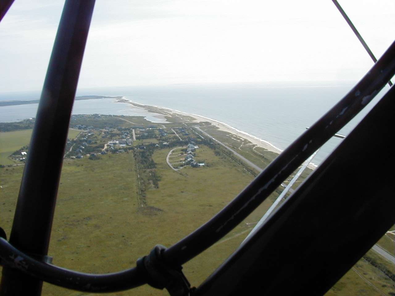
This is an aerial photograph taken in 2000 showing the Mattakessett area of Katama of Martha's Vineyard Island including South Beach. The photo looks to the east. Directly below is conservation land adjacent to the southern end of Katama (Edgartown) airfield. The Mattakessett region of Katama is shown in the central portion of the photograph and is developed with housing. Katama Bay is shown between the distant land mass (Chappaquiddick island) and Katama. South Beach (right side of photo) extends the entire length of Martha's Vineyard island. In this photo it also forms the southern boundary of Katama Bay. The most distant portion of South Beach (defined by the point at which the beach turns left (or north) is named Wasque Point. Submitted by Robert Gagel. I hereby assert that I am the creator of this contribution and agree to publish this text and photo under the GNU Free Documentation License.
I hereby assert that I am the creator of this contribution and it does not violate any third party rights. I agree to release this photo into the public domain. RFG
| Bildnotizen | Diese Datei ist annotiert: Betrachte diese auf Commons. |
Dateiversionen
Klicke auf einen Zeitpunkt, um diese Version zu laden.
| Version vom | Vorschaubild | Maße | Benutzer | Kommentar | |
|---|---|---|---|---|---|
| aktuell | 16:25, 25. Nov. 2006 | | 1.280 × 960 (302 KB) | Rfgagel | This is an aerial photograph taken in 2000 showing the Mattakessett area of Katama of Martha's Vineyard Island including South Beach. The photo looks to the east. Directly below is conservation land adjacent to the southern end of Katama (Edgartown) airfi |
Dateiverwendung
Die folgende Seite verwendet diese Datei:
Globale Dateiverwendung
Die nachfolgenden anderen Wikis verwenden diese Datei:
- Verwendung auf ceb.wikipedia.org
- Verwendung auf www.wikidata.org