Datei:KumamotoMapCurrent.png
Zur Navigation springen
Zur Suche springen

Größe dieser Vorschau: 653 × 600 Pixel. Weitere Auflösungen: 261 × 240 Pixel | 523 × 480 Pixel | 981 × 901 Pixel
Originaldatei (981 × 901 Pixel, Dateigröße: 42 KB, MIME-Typ: image/png)
Dateiversionen
Klicke auf einen Zeitpunkt, um diese Version zu laden.
| Version vom | Vorschaubild | Maße | Benutzer | Kommentar | |
|---|---|---|---|---|---|
| aktuell | 04:08, 23. Mär. 2010 |  | 981 × 901 (42 KB) | Alberth2 | Ueki Town and Jōnan Town were merged into Kumamoto City. |
| 16:57, 15. Dez. 2008 |  | 981 × 901 (42 KB) | Alberth2 | Update | |
| 16:56, 15. Dez. 2008 |  | 981 × 901 (42 KB) | Alberth2 | Update | |
| 16:55, 15. Dez. 2008 |  | 981 × 901 (42 KB) | Alberth2 | Update | |
| 21:54, 29. Jul. 2006 |  | 981 × 901 (41 KB) | Akanemoto~commonswiki | ||
| 21:53, 29. Jul. 2006 |  | 981 × 901 (41 KB) | Akanemoto~commonswiki | fix borders | |
| 00:58, 24. Jul. 2006 |  | 981 × 901 (41 KB) | Akanemoto~commonswiki | ||
| 16:47, 22. Jul. 2006 |  | 981 × 901 (40 KB) | Akanemoto~commonswiki | ||
| 03:00, 22. Jul. 2006 |  | 981 × 901 (40 KB) | Akanemoto~commonswiki | ||
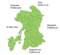
| 22:23, 21. Jul. 2006 |  | 981 × 901 (40 KB) | Akanemoto~commonswiki | Map of Kumamoto Prefecture, Japan. Thanks to Aoki Shigenobu and [http://aoki2.si.gunma-u.ac.jp/map/map.html]. Colors from Image:TokyoMapCurrent.png by User:Fg2. Category:Maps of Kumamoto prefecture Category:Maps in English |
Dateiverwendung
Keine Seiten verwenden diese Datei.
Globale Dateiverwendung
Die nachfolgenden anderen Wikis verwenden diese Datei:
- Verwendung auf be.wikipedia.org
- Verwendung auf ckb.wikipedia.org
- Verwendung auf cs.wikipedia.org
- Verwendung auf fa.wikipedia.org
- Verwendung auf incubator.wikimedia.org
- Verwendung auf lt.wikipedia.org
- Verwendung auf no.wikipedia.org
- Verwendung auf pam.wikipedia.org
- Verwendung auf pl.wikipedia.org
- Verwendung auf ru.wikipedia.org
- Verwendung auf vi.wikipedia.org
- Verwendung auf www.wikidata.org