Datei:LocationSouthYemen.png
Zur Navigation springen
Zur Suche springen
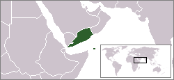
LocationSouthYemen.png (250 × 115 Pixel, Dateigröße: 6 KB, MIME-Typ: image/png)
Dateiversionen
Klicke auf einen Zeitpunkt, um diese Version zu laden.
| Version vom | Vorschaubild | Maße | Benutzer | Kommentar | |
|---|---|---|---|---|---|
| aktuell | 19:56, 4. Jun. 2009 |  | 250 × 115 (6 KB) | Hoshie | Fix the borders based on this map: http://www.lib.utexas.edu/maps/middle_east_and_asia/middle_east_pol_1976.jpg |
| 12:08, 25. Sep. 2007 |  | 250 × 115 (6 KB) | Hoshie | readded the YAR/PDRY/Saudi Arabia boundary. The boundaries during this time in this region were (and in some cases, still are) disputed, undemarcated, or demarcated but undisclosed to the rest of the world. | |
| 08:37, 27. Sep. 2006 |  | 250 × 115 (6 KB) | Hoshie | I have corrected the boundry between the YAR and PDRY. The boundry then was unsettled. See this 1976 map: http://www.lib.utexas.edu/maps/middle_east_and_asia/middle_east_pol_1976.jpg Under same license as original. | |
| 23:02, 14. Feb. 2006 |  | 250 × 115 (6 KB) | Ingc~commonswiki | Location Map of Democratic Popoular Yemen. {{PD}} source:"http://en.wikipedia.org/wiki/Repubblica_Democratica_Popolare_dello_Yemen" | |
| 12:59, 11. Okt. 2005 |  | 250 × 115 (6 KB) | ChongDae | This image was copied from wikipedia:en. The original description was: Map showing South Yemen.<br> <br> <i>(Note: This map is old and therefore shows Eritrea as being part of Ethiopia)</i> {{GFDL}} {| border="1" ! date/time || username || edit summ |
Dateiverwendung
Keine Seiten verwenden diese Datei.


