Datei:Map of Eyre Peninsula, South Australia, showing places with a population of more than 500.jpg
Zur Navigation springen
Zur Suche springen
Größe dieser Vorschau: 621 × 599 Pixel. Weitere Auflösungen: 249 × 240 Pixel | 497 × 480 Pixel | 796 × 768 Pixel | 1.061 × 1.024 Pixel | 2.122 × 2.048 Pixel | 4.317 × 4.166 Pixel
Originaldatei (4.317 × 4.166 Pixel, Dateigröße: 11 MB, MIME-Typ: image/jpeg)
![]()
Diese Datei und die Informationen unter dem roten Trennstrich werden aus dem zentralen Medienarchiv Wikimedia Commons eingebunden.
![]()
Beschreibung
| Beschreibung |
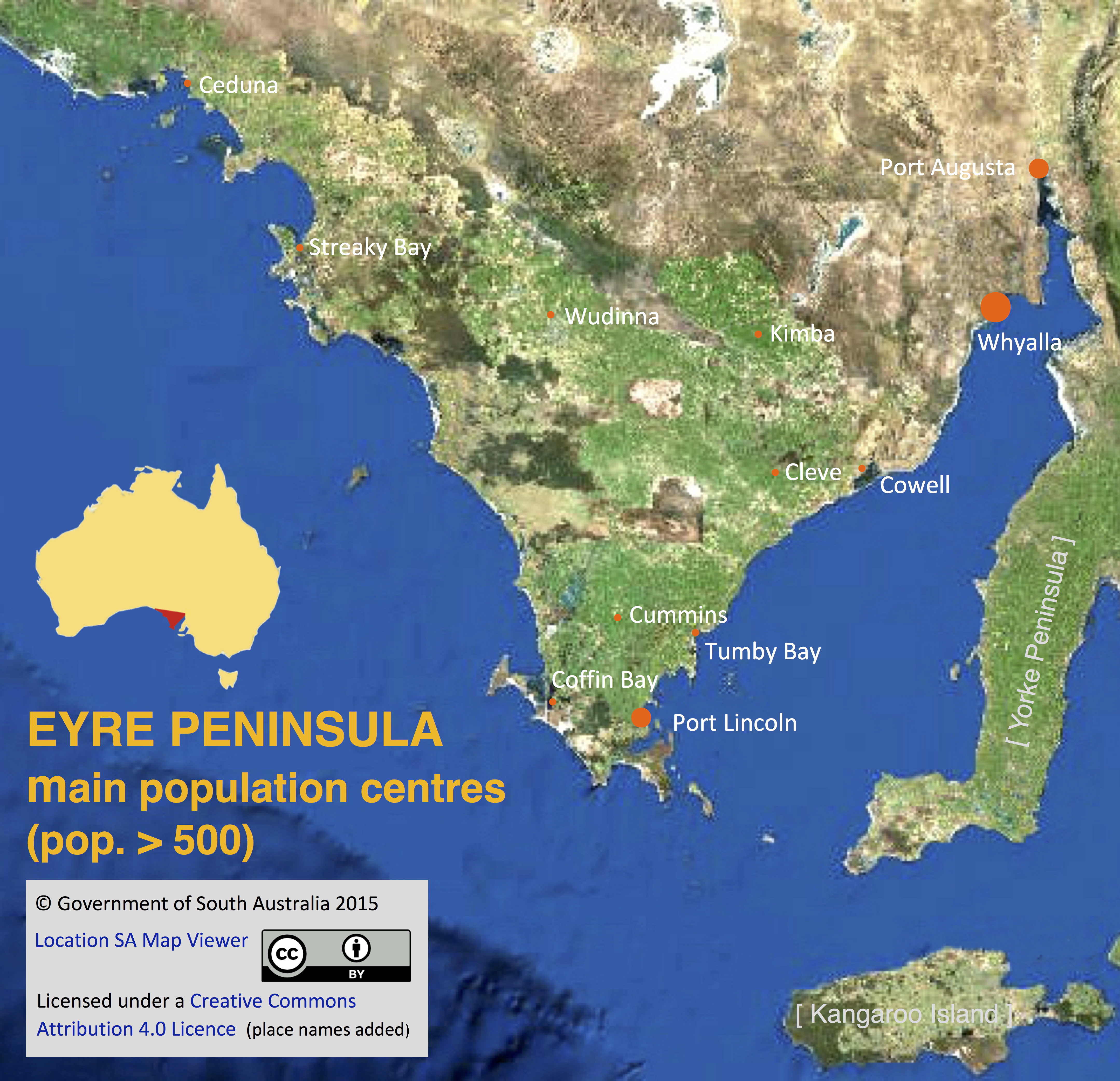
English: A satellite image of Eyre Peninsula, South Australia, imposed with names and locations of towns and cities with a population of more than 500 as recorded in the 2011 Australian census. |
| Datum | |
| Quelle | http://location.sa.gov.au/viewer/ |
| Urheber | Government of South Australia |
| Genehmigung (Weiternutzung dieser Datei) |
At the source page, the 'Help' menu pop-down includes the statement 'This Government of South Australia website is licensed under a Creative Commons Attribution 4.0 Licence. © Copyright 2015' |
- Other information
English: Names and locations of population centres have been added to the image by SCHolar44, as permitted by CC BY 4.0, together with copyright information.
Lizenz
Diese Datei ist lizenziert unter der Creative-Commons-Lizenz „Namensnennung 4.0 international“.
- Dieses Werk darf von dir
- verbreitet werden – vervielfältigt, verbreitet und öffentlich zugänglich gemacht werden
- neu zusammengestellt werden – abgewandelt und bearbeitet werden
- Zu den folgenden Bedingungen:
- Namensnennung – Du musst angemessene Urheber- und Rechteangaben machen, einen Link zur Lizenz beifügen und angeben, ob Änderungen vorgenommen wurden. Diese Angaben dürfen in jeder angemessenen Art und Weise gemacht werden, allerdings nicht so, dass der Eindruck entsteht, der Lizenzgeber unterstütze gerade dich oder deine Nutzung besonders.
Dateiversionen
Klicke auf einen Zeitpunkt, um diese Version zu laden.
| Version vom | Vorschaubild | Maße | Benutzer | Kommentar | |
|---|---|---|---|---|---|
| aktuell | 11:23, 6. Sep. 2017 | | 4.317 × 4.166 (11 MB) | SCHolar44 | {{subst:Upload marker added by en.wp UW}} {{Information |Description = {{en|A satellite image of Eyre Peninsula, South Australia, imposed with names and locations of towns and cities with a population of more than 500 as recorded in the 2011 Australian... |
Dateiverwendung
Die folgende Seite verwendet diese Datei:
Globale Dateiverwendung
Die nachfolgenden anderen Wikis verwenden diese Datei:
- Verwendung auf en.wikipedia.org