Datei:Old cadastral map of Praha-Josefov and surround areas.jpg

Originaldatei (3.328 × 2.976 Pixel, Dateigröße: 4,73 MB, MIME-Typ: image/jpeg)
![]()
Diese Datei und die Informationen unter dem roten Trennstrich werden aus dem zentralen Medienarchiv Wikimedia Commons eingebunden.
![]()
Beschreibung
| Beschreibung |
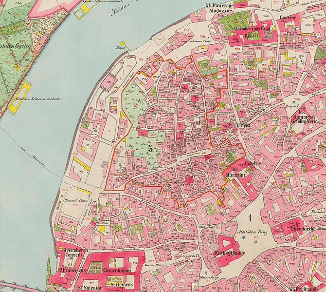
English: Old cadastral map of original Praha-Josefov cadastral area and surround areas
Čeština: Mapa stabilního katastru Prahy-Josefova s okolím, pocházející z řady povinných císařských otisků. Mapováno 1842, opravené vydání 1852. |
| Datum | |
| Quelle | http://archivnimapy.cuzk.cz/coc/6068-1/6068-1-002_index.html |
| Urheber | Offices of the Austrian Empire |
|
Dieses Werk ist gemeinfrei, weil seine urheberrechtliche Schutzfrist abgelaufen ist. Dieses Werk ist gemeinfrei in den Vereinigten Staaten, weil es vor dem 1. Januar 1929 veröffentlicht (oder beim U.S. Copyright Office registriert) wurde. | |
| Es wurde festgestellt, dass diese Datei frei von bekannten Beschränkungen durch das Urheberrecht ist, alle verbundenen und verwandten Rechte eingeschlossen. | |

|
Diese Datei wurde auf der Grundlage von Daten erstellt, die vom Zentralarchiv für Vermessung, Kartierung und Kataster (Tschechischen Amt für Vermessung, Kartierung und Kataster) zur Verfügung gestellt wurden.
|
Dateiversionen
Klicke auf einen Zeitpunkt, um diese Version zu laden.
| Version vom | Vorschaubild | Maße | Benutzer | Kommentar | |
|---|---|---|---|---|---|
| aktuell | 17:04, 28. Jan. 2015 | | 3.328 × 2.976 (4,73 MB) | MagentaGreen | Wasserzeichen entfernt; Bildzuschnitt (Vielfaches von 16 px); Photoshop Speicheroptionen: Qualität 11 (97%) |
| 00:46, 28. Jan. 2013 |  | 3.331 × 2.981 (6,87 MB) | Slick-o-bot | Bot: convert to a non-interlaced jpeg (see bug #17645) | |
| 01:07, 5. Jun. 2008 |  | 3.331 × 2.981 (6,16 MB) | Kirk979 | {{Information |Description={{en|1=Old cadastral map of original Praha-Josefov cadastral area and surround areas}} {{cs|1=Stará katastrální mapa původního katastru Prahy-Josefova s okolím, pocházející z řady povinných císařských otisků}} |So |
Dateiverwendung
Die folgende Seite verwendet diese Datei:
Globale Dateiverwendung
Die nachfolgenden anderen Wikis verwenden diese Datei:
- Verwendung auf cs.wikipedia.org
- Verwendung auf eu.wikipedia.org