Datei:Paris europe train map de.png
Zur Navigation springen
Zur Suche springen
Größe dieser Vorschau: 552 × 600 Pixel. Weitere Auflösungen: 221 × 240 Pixel | 442 × 480 Pixel | 707 × 768 Pixel | 1.024 × 1.113 Pixel
Originaldatei (1.024 × 1.113 Pixel, Dateigröße: 63 KB, MIME-Typ: image/png)
![]()
Diese Datei und die Informationen unter dem roten Trennstrich werden aus dem zentralen Medienarchiv Wikimedia Commons eingebunden.
![]()
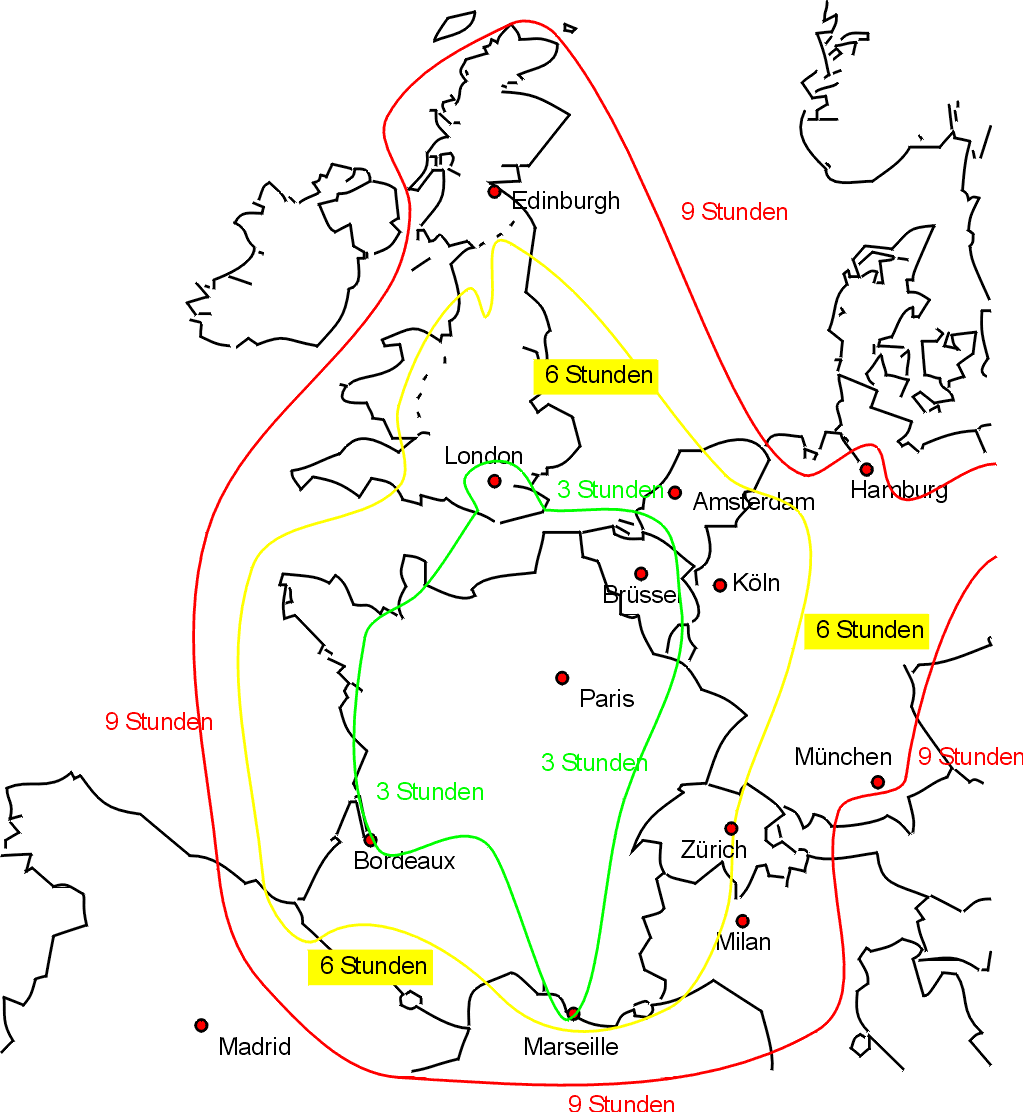
Reisezeiten für Züge von Paris.
Sketch map showing approximate journey times on the train from Paris to the rest of western Europe, with text in German (my apologies for any translation errors).
Drawn by Bob Tubbs, based on queries to the SNCF website.
Original English version at Image:paris_europe_train_map.png
| Ich, der Urheberrechtsinhaber dieses Werkes, veröffentliche es als gemeinfrei. Dies gilt weltweit. In manchen Staaten könnte dies rechtlich nicht möglich sein. Sofern dies der Fall ist: Ich gewähre jedem das bedingungslose Recht, dieses Werk für jedweden Zweck zu nutzen, es sei denn, Bedingungen sind gesetzlich erforderlich. |
Dateiversionen
Klicke auf einen Zeitpunkt, um diese Version zu laden.
| Version vom | Vorschaubild | Maße | Benutzer | Kommentar | |
|---|---|---|---|---|---|
| aktuell | 22:26, 29. Jul. 2006 | | 1.024 × 1.113 (63 KB) | Rnt20 | |
| 22:12, 31. Mai 2005 |  | 1.024 × 1.113 (62 KB) | Rnt20 | Sketch map showing approximate journey times on the train from Paris to the rest of western Europe, with text in German (my apologies for any translation errors). Drawn by Bob Tubbs, based on queries to the SNCF website. Original English version at [[Im | |
| 22:12, 31. Mai 2005 |  | 1.024 × 1.113 (62 KB) | Rnt20 | Sketch map showing approximate journey times on the train from Paris to the rest of western Europe, with text in German (my apologies for any translation errors). Drawn by Bob Tubbs, based on queries to the SNCF website. Original English version at [[Im |
Dateiverwendung
Die folgenden 2 Seiten verwenden diese Datei:
Globale Dateiverwendung
Die nachfolgenden anderen Wikis verwenden diese Datei:
- Verwendung auf uk.wikipedia.org