Datei:Volta districts.png
Zur Navigation springen
Zur Suche springen
Größe dieser Vorschau: 776 × 600 Pixel. Weitere Auflösungen: 311 × 240 Pixel | 621 × 480 Pixel | 994 × 768 Pixel | 1.056 × 816 Pixel
Originaldatei (1.056 × 816 Pixel, Dateigröße: 43 KB, MIME-Typ: image/png)
![]()
Diese Datei und die Informationen unter dem roten Trennstrich werden aus dem zentralen Medienarchiv Wikimedia Commons eingebunden.
![]()
Beschreibung
| Beschreibung |
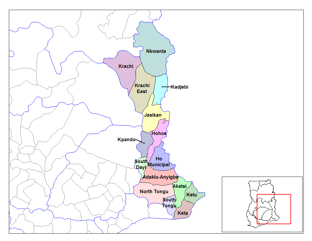
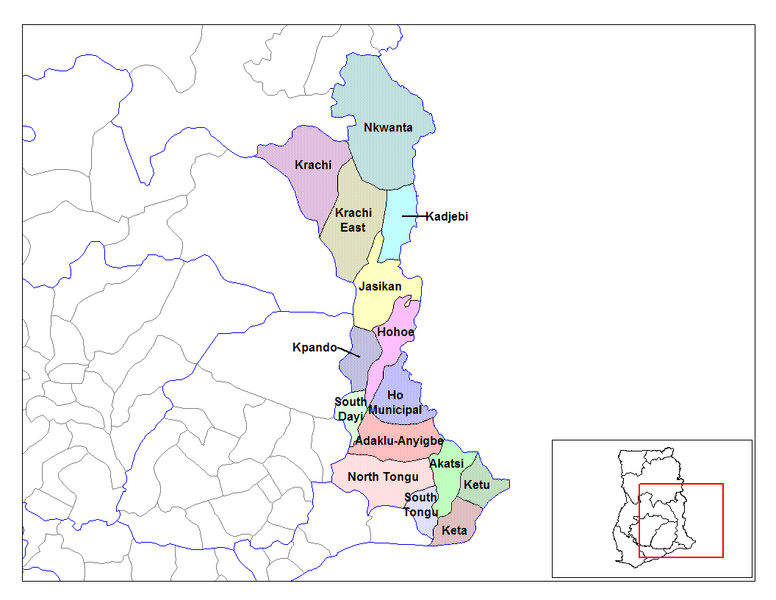
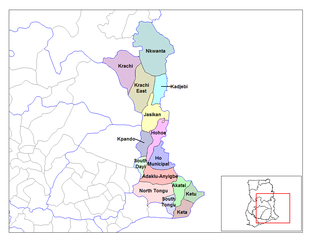
English: Map of the districts of the Volta region of Ghana. Created by Rarelibra for public domain use. Created using MapInfo Professional v7.5 and various mapping resources. |
| Datum | 28. Juni 2006 (Original-Hochladedatum) |
| Quelle | Eigenes Werk |
| Urheber | User:Rarelibra |
Lizenz
| Ich, der Urheberrechtsinhaber dieses Werkes, veröffentliche es als gemeinfrei. Dies gilt weltweit. In manchen Staaten könnte dies rechtlich nicht möglich sein. Sofern dies der Fall ist: Ich gewähre jedem das bedingungslose Recht, dieses Werk für jedweden Zweck zu nutzen, es sei denn, Bedingungen sind gesetzlich erforderlich. |
Ursprüngliches Datei-Logbuch
- (del) (cur) 08:03, 5 March 2006 . . Rarelibra (Talk | contribs) . . 1056x816 (44,138 bytes) (Map of the districts of the Volta region of Ghana. Created by Rarelibra for public domain use. Created using MapInfo Professional v7.5 and various mapping resources.)
Dateiversionen
Klicke auf einen Zeitpunkt, um diese Version zu laden.
| Version vom | Vorschaubild | Maße | Benutzer | Kommentar | |
|---|---|---|---|---|---|
| aktuell | 16:01, 28. Jun. 2006 | | 1.056 × 816 (43 KB) | Ahanta | from en:districts of ghana Map of the districts of the Volta region of Ghana. Created by Rarelibra for public domain use. Created using MapInfo Professional v7.5 and various mapping resources. [edit] I, the creator of this work, hereby release it into th |
Dateiverwendung
Die folgenden 2 Seiten verwenden diese Datei:
Globale Dateiverwendung
Die nachfolgenden anderen Wikis verwenden diese Datei:
- Verwendung auf ca.wikipedia.org
- Verwendung auf ceb.wikipedia.org
- Verwendung auf dag.wikipedia.org
- Verwendung auf da.wikipedia.org
- Verwendung auf ee.wikipedia.org
- Verwendung auf en.wikipedia.org
- Verwendung auf es.wikipedia.org
- Verwendung auf fa.wikipedia.org
- Verwendung auf fr.wikipedia.org
- District (Ghana)
- Région de la Volta
- Adaklu-Anyigbe
- Akatsi
- Dayi sud
- Tongu nord
- Tongu sud
- Nkwanta sud
- Kpando
- Kadjebi
- Jasikan
- District municipal de Keta
- Ketu sud
- Ketu nord
- Nkwanta nord
- Biakoye
- District municipal d'Ho
- District municipal d'Hohoe
- Krachi est
- Krachi ouest
- Modèle:Infobox District du Ghana
- Modèle:Infobox District du Ghana/Documentation
- Verwendung auf gpe.wikipedia.org
- Verwendung auf ha.wikipedia.org
- Verwendung auf ig.wikipedia.org
- Verwendung auf it.wikipedia.org
Weitere globale Verwendungen dieser Datei anschauen.