Datei:1751 Anson Map of Baja California and the Pacific, Trade Routes from Acapulco to Manila - Geographicus - MerduSud-anson-1751.jpg
Zur Navigation springen
Zur Suche springen

Größe dieser Vorschau: 799 × 282 Pixel. Weitere Auflösungen: 320 × 113 Pixel | 640 × 226 Pixel | 1.024 × 361 Pixel | 1.280 × 452 Pixel | 2.560 × 904 Pixel | 6.000 × 2.118 Pixel
Originaldatei (6.000 × 2.118 Pixel, Dateigröße: 3,54 MB, MIME-Typ: image/jpeg)
![]()
Diese Datei und die Informationen unter dem roten Trennstrich werden aus dem zentralen Medienarchiv Wikimedia Commons eingebunden.
![]()
Beschreibung
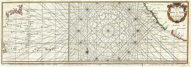
| Carte de la Mer du Sud ou Mer Pacifique entre l'Equateur et le 39 1-2 . De Latitude Septentrionale. | ||||||
|---|---|---|---|---|---|---|
| Künstler | ||||||
| Titel |
Carte de la Mer du Sud ou Mer Pacifique entre l'Equateur et le 39 1-2 . De Latitude Septentrionale. |
|||||
| Beschreibung |
English: This is a rare 1750 nautical chart of the Pacific Ocean by the French map publisher N. Bellin.
|
|||||
| Datum | 1750 (undated) | |||||
| Maße | Höhe: 12 in (30,4 cm); Breite: 34 in (86,3 cm) | |||||
| Inventarnummer |
Geographicus link: MerduSud-anson-1751 |
|||||
| Herkunft/Fotograf |
Anson, G., Voyage Autour du Monde, Fait Dans Les anees 1740, 41, 42, 43, & 44, 1751 Paris Edition.
|
|||||
| Genehmigung (Weiternutzung dieser Datei) |
|
|||||
Dateiversionen
Klicke auf einen Zeitpunkt, um diese Version zu laden.
| Version vom | Vorschaubild | Maße | Benutzer | Kommentar | |
|---|---|---|---|---|---|
| aktuell | 00:29, 24. Mär. 2011 | 6.000 × 2.118 (3,54 MB) | BotMultichillT | {{subst:User:Multichill/Geographicus |link=http://www.geographicus.com/P/AntiqueMap/MerduSud-anson-1751 |product_name=1751 Anson Map of Baja California and the Pacific, Trade Routes from Acapulco to Manila |map_title=Carte de la Mer du Sud ou Mer Pacifiqu |
Dateiverwendung
Die folgende Seite verwendet diese Datei:
Globale Dateiverwendung
Die nachfolgenden anderen Wikis verwenden diese Datei:
- Verwendung auf en.wikipedia.org
- Verwendung auf hy.wikipedia.org