Datei:Dupontmap.png
Zur Navigation springen
Zur Suche springen

Größe dieser Vorschau: 775 × 600 Pixel. Weitere Auflösungen: 310 × 240 Pixel | 620 × 480 Pixel | 993 × 768 Pixel | 1.280 × 991 Pixel | 2.560 × 1.981 Pixel | 2.950 × 2.283 Pixel
Originaldatei (2.950 × 2.283 Pixel, Dateigröße: 2,63 MB, MIME-Typ: image/png)
![]()
Diese Datei und die Informationen unter dem roten Trennstrich werden aus dem zentralen Medienarchiv Wikimedia Commons eingebunden.
![]()
|
Dieses Bild zeigt ein Objekt, das im National Register of Historic Places der Vereinigten Staaten verzeichnet ist. Die Referenznummer lautet 78003056. |
Beschreibung
| Beschreibung |
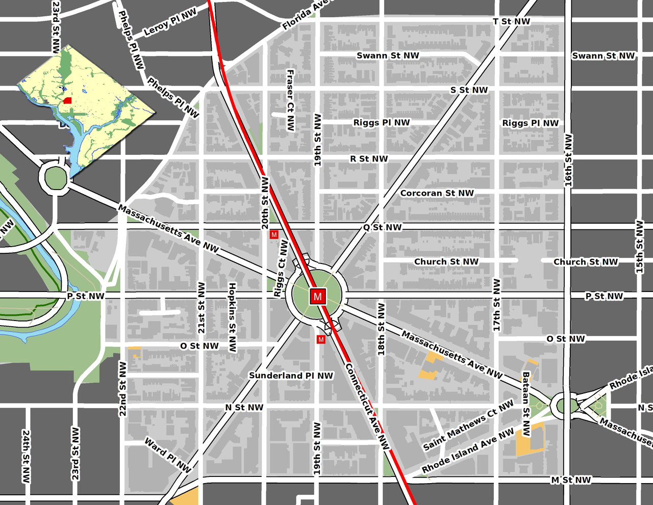
English: Map of the Dupont Circle neighborhood in Washington, D.C.
GIS data comes from Open Street Map and DC GIS (okay to use here [1]) |
| Datum | |
| Quelle | Eigenes Werk |
| Urheber | Aude |
| Objektposition | | Dieses und weitere Bilder auf OpenStreetMap |
|---|
Lizenz
Ich, der Urheber dieses Werkes, veröffentliche es unter der folgenden Lizenz:
Diese Datei ist unter der Creative-Commons-Lizenz „Namensnennung 3.0 nicht portiert“ lizenziert.
- Dieses Werk darf von dir
- verbreitet werden – vervielfältigt, verbreitet und öffentlich zugänglich gemacht werden
- neu zusammengestellt werden – abgewandelt und bearbeitet werden
- Zu den folgenden Bedingungen:
- Namensnennung – Du musst angemessene Urheber- und Rechteangaben machen, einen Link zur Lizenz beifügen und angeben, ob Änderungen vorgenommen wurden. Diese Angaben dürfen in jeder angemessenen Art und Weise gemacht werden, allerdings nicht so, dass der Eindruck entsteht, der Lizenzgeber unterstütze gerade dich oder deine Nutzung besonders.
Dateiversionen
Klicke auf einen Zeitpunkt, um diese Version zu laden.
| Version vom | Vorschaubild | Maße | Benutzer | Kommentar | |
|---|---|---|---|---|---|
| aktuell | 21:15, 30. Jan. 2009 | | 2.950 × 2.283 (2,63 MB) | Aude | {{Information |Description={{en|1=Map of the Dupont Circle neighborhood in Washington, D.C. GIS data comes from [http://www.openstreetmap.org/ Open Street Map] and [http://dcatlas.dcgis.dc.gov/catalog/ DC GIS] (okay to use here [http://lists.openstreetma |
Dateiverwendung
Die folgende Seite verwendet diese Datei:
Globale Dateiverwendung
Die nachfolgenden anderen Wikis verwenden diese Datei:
- Verwendung auf ca.wikipedia.org
- Verwendung auf es.wikipedia.org
- Verwendung auf pt.wikipedia.org