Datei:Iwate - Miyako - Taro -a- Tsunami heights -b- Part of the breakwater destroyed by the 2011 tsunami.jpg
Zur Navigation springen
Zur Suche springen
Größe dieser Vorschau: 390 × 600 Pixel. Weitere Auflösungen: 156 × 240 Pixel | 312 × 480 Pixel | 499 × 768 Pixel | 666 × 1.024 Pixel | 1.292 × 1.987 Pixel
Originaldatei (1.292 × 1.987 Pixel, Dateigröße: 599 KB, MIME-Typ: image/jpeg)
![]()
Diese Datei und die Informationen unter dem roten Trennstrich werden aus dem zentralen Medienarchiv Wikimedia Commons eingebunden.
![]()
Beschreibung
| Beschreibung |
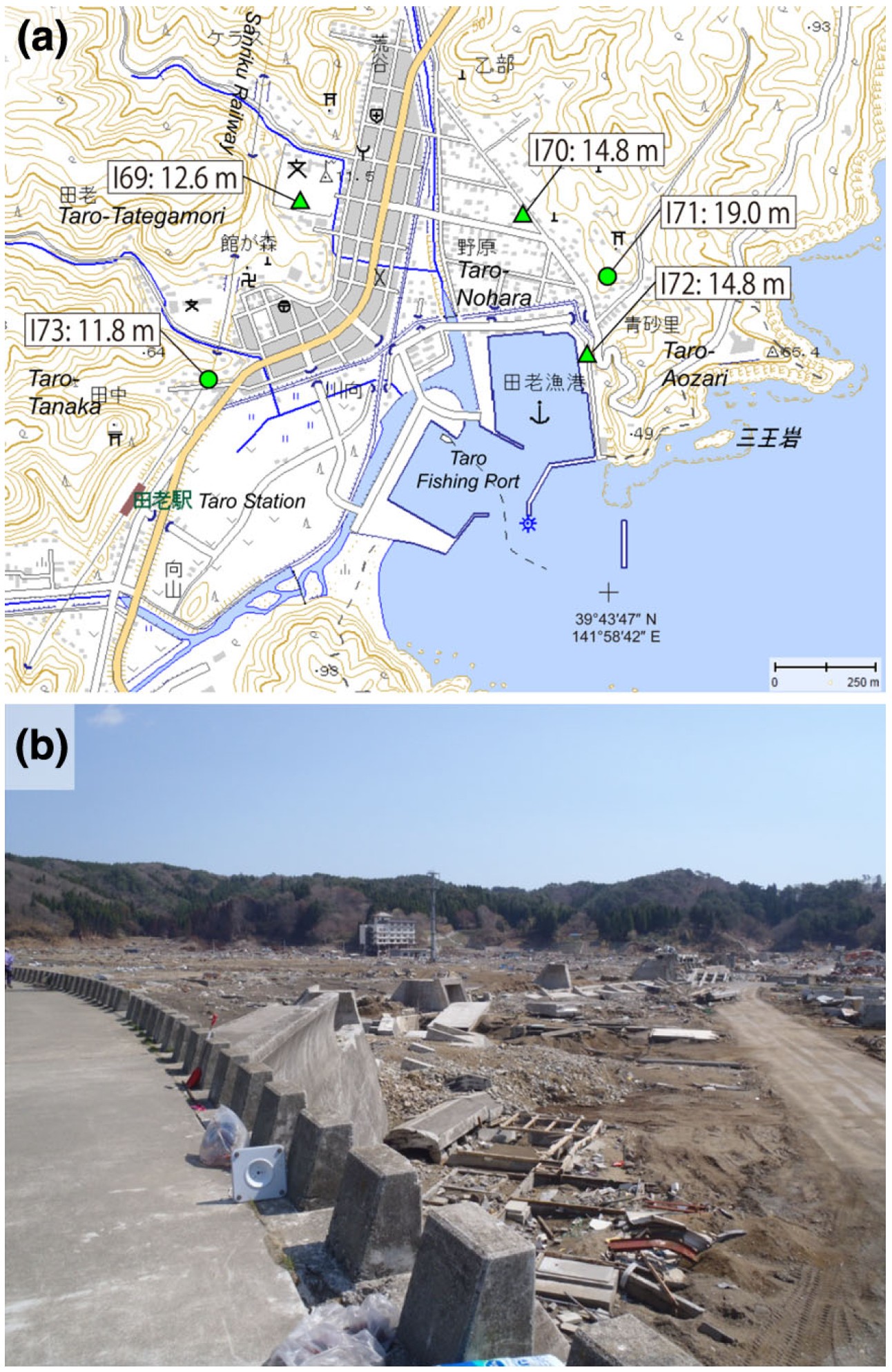
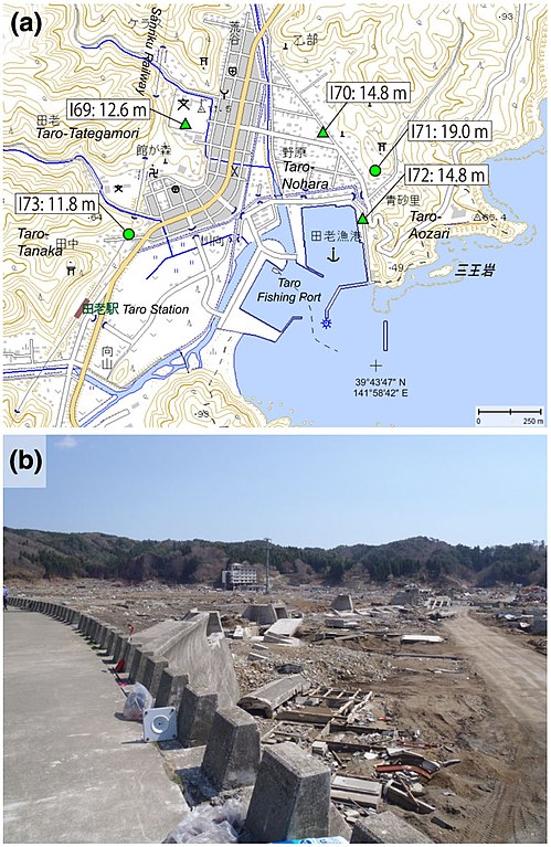
English: Source: Yoshinobu Tsuji, Kenji Satake, Takeo Ishibe, Tomoya Harada, Akihito Nishiyama, Satoshi Kusumoto: "Tsunami Heights along the Pacific Coast of Northern Honshu Recorded from the 2011 Tohoku", Pure and Applied Geophysics, 171, 12, (2014), pp. 3183–3215, DOI:10.1007/s00024-014-0779-x, online published on 19 March 2014. License: Creative Commons Attribution 4.0 International (CC BY 4.0). Here p. 3189, Figure 6.
Caption as given in the above cited source: "Figure 6 - a Tsunami heights at Taro-Tategamori (I69), Taro-Nohara (I70), Taro-Aozari (I71 and I72), and Taro-Tanaka (I73), Miyako City, Iwate Prefecture. The symbols and their meanings are the same as in Fig. 3. b Part of the breakwater destroyed by the 2011 tsunami. The building in the background is a hotel that the tsunami damaged up to the third floor (14.8 m; I70)" Context as given in the above cited source: "At Taro in Miyako City, coastal levees with a height of 10 m and a total length of *2.4 km had been constructed; however, the 2011 tsunami destroyed a portion of these coastal levees, and transported blocks and other debris from the structure more than 100 m inland (Fig. 6). Almost all houses and fishing facilities were swept away or were completely leveled. The first three floors of a hotel were severely damaged, indicating an inundation height of 14.8 m (I70). Tsunami traces on the wall of a Japan Fisheries Cooperatives icehouse indicate the same inundation height (I72). Runup heights of 11.8 m (I73) and 19.0 m (I71) were measured at the western and eastern part of the residential area, respectively. Tsunami trace at a middle school indicates an inundation height of 12.6 m (I69)." |
| Datum | |
| Quelle | Yoshinobu Tsuji, Kenji Satake, Takeo Ishibe, Tomoya Harada, Akihito Nishiyama, Satoshi Kusumoto: "Tsunami Heights along the Pacific Coast of Northern Honshu Recorded from the 2011 Tohoku", Pure and Applied Geophysics, 171, 12, (2014), pp. 3183–3215, DOI:10.1007/s00024-014-0779-x, online published on 19 March 2014. License: Creative Commons Attribution 4.0 International (CC BY 4.0). Here p. 3189, Figure 6. |
| Urheber | Yoshinobu Tsuji, Kenji Satake, Takeo Ishibe, Tomoya Harada, Akihito Nishiyama, Satoshi Kusumoto: "Tsunami Heights along the Pacific Coast of Northern Honshu Recorded from the 2011 Tohoku", Pure and Applied Geophysics, 171, 12, (2014), pp. 3183–3215, DOI:10.1007/s00024-014-0779-x, online published on 19 March 2014. License: Creative Commons Attribution 4.0 International (CC BY 4.0). Here p. 3189, Figure 6. |
| Genehmigung (Weiternutzung dieser Datei) |
Diese Datei ist lizenziert unter der Creative-Commons-Lizenz „Namensnennung 4.0 international“.
|
Lizenz
Diese Datei ist lizenziert unter der Creative-Commons-Lizenz „Namensnennung 4.0 international“.
- Dieses Werk darf von dir
- verbreitet werden – vervielfältigt, verbreitet und öffentlich zugänglich gemacht werden
- neu zusammengestellt werden – abgewandelt und bearbeitet werden
- Zu den folgenden Bedingungen:
- Namensnennung – Du musst angemessene Urheber- und Rechteangaben machen, einen Link zur Lizenz beifügen und angeben, ob Änderungen vorgenommen wurden. Diese Angaben dürfen in jeder angemessenen Art und Weise gemacht werden, allerdings nicht so, dass der Eindruck entsteht, der Lizenzgeber unterstütze gerade dich oder deine Nutzung besonders.
Dateiversionen
Klicke auf einen Zeitpunkt, um diese Version zu laden.
| Version vom | Vorschaubild | Maße | Benutzer | Kommentar | |
|---|---|---|---|---|---|
| aktuell | 13:40, 16. Aug. 2018 | | 1.292 × 1.987 (599 KB) | Anglo-Araneophilus~commonswiki | {{Information |description ={{en|1=Source: Yoshinobu Tsuji, Kenji Satake, Takeo Ishibe, Tomoya Harada, Akihito Nishiyama, Satoshi Kusumoto: "Tsunami Heights along the Pacific Coast of Northern Honshu Recorded from the 2011 Tohoku", Pure and Applied Geophysics, 171, 12, (2014), pp. 3183–3215, DOI:10.1007/s00024-014-0779-x, online published on 19 March 2014. License: Creative Commons Attribution 4.0 International (CC BY 4.0). Here p. 3189, Figure 6. Caption as given in the above cited source... |
Dateiverwendung
Die folgende Seite verwendet diese Datei: