Datei:Map CZ - district Rokycany.PNG
Zur Navigation springen
Zur Suche springen

Größe dieser Vorschau: 800 × 548 Pixel. Weitere Auflösungen: 320 × 219 Pixel | 640 × 439 Pixel | 1.024 × 702 Pixel | 1.281 × 878 Pixel
Originaldatei (1.281 × 878 Pixel, Dateigröße: 22 KB, MIME-Typ: image/png)
![]()
Diese Datei und die Informationen unter dem roten Trennstrich werden aus dem zentralen Medienarchiv Wikimedia Commons eingebunden.
![]()
Beschreibung
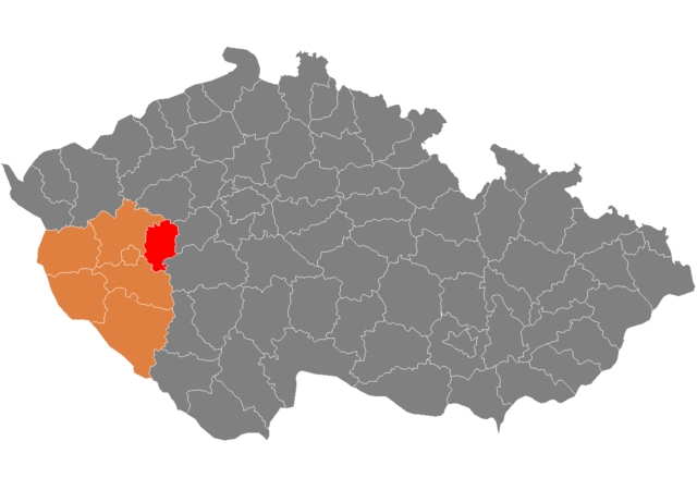
| Beschreibung | Location of Rokycany District in Plzeň Region and the Czech Republic. |
| Quelle | self-made, based on Image:Czech_Republic_districts.png |
| Urheber | Hanhil |
Lizenz
| Ich, der Urheberrechtsinhaber dieses Werkes, veröffentliche es als gemeinfrei. Dies gilt weltweit. In manchen Staaten könnte dies rechtlich nicht möglich sein. Sofern dies der Fall ist: Ich gewähre jedem das bedingungslose Recht, dieses Werk für jedweden Zweck zu nutzen, es sei denn, Bedingungen sind gesetzlich erforderlich. |
Dateiversionen
Klicke auf einen Zeitpunkt, um diese Version zu laden.
| Version vom | Vorschaubild | Maße | Benutzer | Kommentar | |
|---|---|---|---|---|---|
| aktuell | 21:45, 11. Feb. 2008 | | 1.281 × 878 (22 KB) | Hanhil | {{Information |Description=Locator_maps_of_districts_of_the_Czech_Republic. |Source=self-made, based on Image:Czech_Republic_districts.png |Date= |Author= Hanhil }} == Licensing == {{PD-self}} [[category:Locator_maps_of_districts_of |
Dateiverwendung
Die folgende Seite verwendet diese Datei:
Globale Dateiverwendung
Die nachfolgenden anderen Wikis verwenden diese Datei:
- Verwendung auf ar.wikipedia.org
- Verwendung auf azb.wikipedia.org
- Verwendung auf bg.wikipedia.org
- Verwendung auf en.wikipedia.org
- Verwendung auf fa.wikipedia.org
- Verwendung auf frr.wikipedia.org
- Verwendung auf fr.wikipedia.org
- Verwendung auf hu.wikipedia.org
- Verwendung auf it.wikipedia.org
- Verwendung auf ka.wikipedia.org
- Verwendung auf ms.wikipedia.org
- Verwendung auf nl.wikipedia.org
- Verwendung auf pl.wikipedia.org
- Verwendung auf pnb.wikipedia.org
- Verwendung auf pt.wikipedia.org
- Rokycany (distrito)
- Rokycany
- Predefinição:Distrito de Rokycany
- Zvíkovec
- Bezděkov (Rokycany)
- Břasy
- Březina (Plzeň)
- Bujesily
- Bušovice
- Cekov
- Cheznovice
- Chlum (Rokycany)
- Chomle
- Čilá
- Dobřív
- Drahoňův Újezd
- Ejpovice
- Hlohovice
- Holoubkov
- Hradiště (Rokycany)
- Hůrky
- Kakejcov
- Kamenec
- Kamenný Újezd (Plzeň)
- Kařez
- Kařízek
- Klabava
- Kladruby (Rokycany)
- Kornatice
- Lhota pod Radčem
- Lhotka u Radnic
- Liblín
- Líšná (Plzeň)
- Litohlavy
- Medový Újezd
- Mešno
Weitere globale Verwendungen dieser Datei anschauen.