Datei:Salisbury Tunnel Junction collision aerial.jpg
Zur Navigation springen
Zur Suche springen
Größe dieser Vorschau: 800 × 533 Pixel. Weitere Auflösungen: 320 × 213 Pixel | 640 × 427 Pixel | 960 × 640 Pixel
Originaldatei (960 × 640 Pixel, Dateigröße: 937 KB, MIME-Typ: image/jpeg)
![]()
Diese Datei und die Informationen unter dem roten Trennstrich werden aus dem zentralen Medienarchiv Wikimedia Commons eingebunden.
![]()
Beschreibung
| Beschreibung |
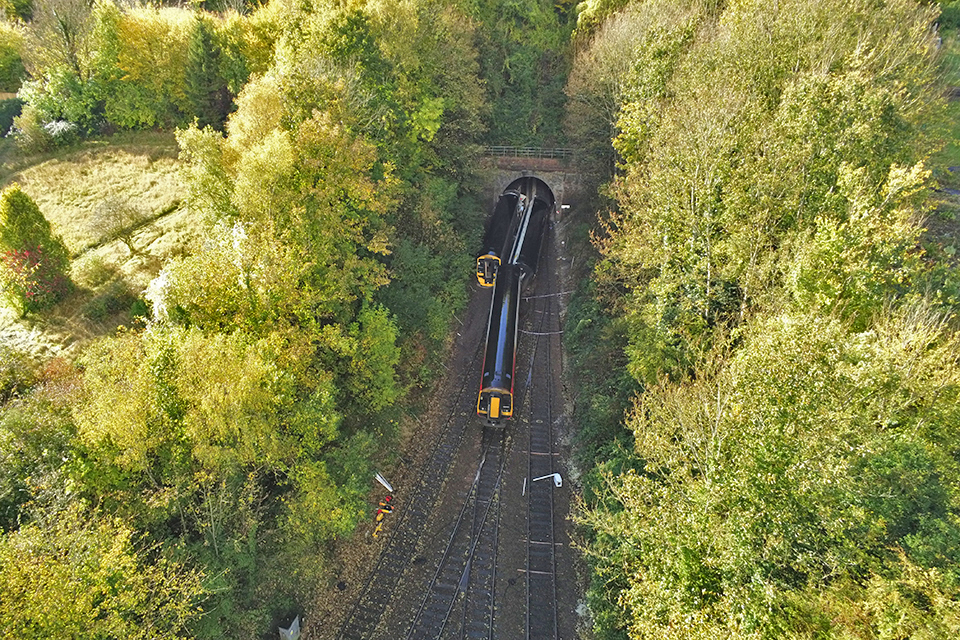
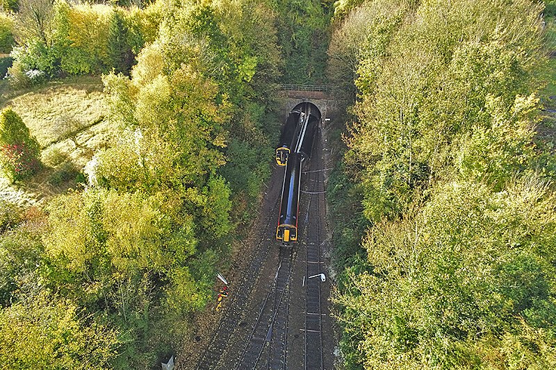
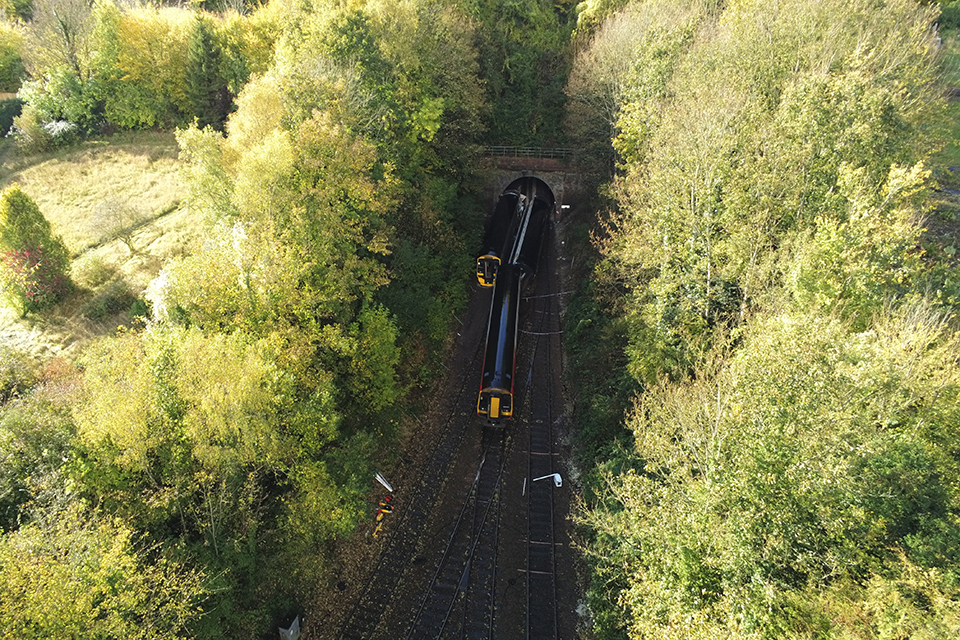
English: Aerial view of Salisbury Tunnel Junction after the collision between two trains on 31 October 2021.
Deutsch: Luftbild der Salisbury Tunnel Junction nach der Kollision zweier Züge am 31. Oktober 2021. |
| Datum | |
| Quelle | https://assets.publishing.service.gov.uk/government/uploads/system/uploads/image_data/file/134477/Figure_1.jpg |
| Urheber | Rail Accident Investigation Branch |
| Kameraposition | | Dieses und weitere Bilder auf OpenStreetMap |
|---|
Lizenz
_(St_Edwards_Crown).svg)
|
This file is licensed under the United Kingdom Open Government Licence v3.0. |
See also: Meta for information on usage on Wikimedia wikis.
|
Dateiversionen
Klicke auf einen Zeitpunkt, um diese Version zu laden.
| Version vom | Vorschaubild | Maße | Benutzer | Kommentar | |
|---|---|---|---|---|---|
| aktuell | 11:43, 30. Okt. 2022 | | 960 × 640 (937 KB) | Murgatroyd49 | Image brightened |
| 16:01, 5. Nov. 2021 |  | 960 × 640 (888 KB) | PhiH | Uploaded a work by Rail Accident Investigation Branch from https://assets.publishing.service.gov.uk/government/uploads/system/uploads/image_data/file/134477/Figure_1.jpg with UploadWizard |
Dateiverwendung
Die folgende Seite verwendet diese Datei:
Globale Dateiverwendung
Die nachfolgenden anderen Wikis verwenden diese Datei:
- Verwendung auf en.wikipedia.org