Datei:USACE Mansfield Hollow Lake.jpg
Zur Navigation springen
Zur Suche springen
Größe dieser Vorschau: 748 × 600 Pixel. Weitere Auflösungen: 299 × 240 Pixel | 599 × 480 Pixel | 958 × 768 Pixel | 1.277 × 1.024 Pixel | 1.500 × 1.203 Pixel
Originaldatei (1.500 × 1.203 Pixel, Dateigröße: 1,53 MB, MIME-Typ: image/jpeg)
![]()
Diese Datei und die Informationen unter dem roten Trennstrich werden aus dem zentralen Medienarchiv Wikimedia Commons eingebunden.
![]()
|
Dieses Bild zeigt ein Objekt, das im National Register of Historic Places der Vereinigten Staaten verzeichnet ist. Die Referenznummer lautet 3000194. |
| Beschreibung |
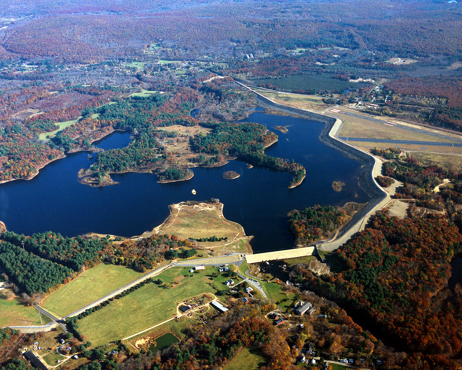
English: Mansfield Hollow Lake in Tolland County, Mansfield, Connecticut, USA. The U.S. Army Corps of Engineers constructed the dam as a flood control measure. It impounds the waters of the Fenton, Mount Hope, and Natchaug Rivers. |
|||
| Datum | 10. April 1999 (Date as given in the description, but the date seems unlikely given the autumn color in the landscape.) | |||
| Quelle |
U.S. Army Corps of Engineers Digital Visual Library Image page Image description page Digital Visual Library home page |
|||
| Urheber | U.S. Army Corps of Engineers, photographer not specified or unknown | |||
| Genehmigung (Weiternutzung dieser Datei) |
|
| Kameraposition | | Dieses und weitere Bilder auf OpenStreetMap |
|---|
Dateiversionen
Klicke auf einen Zeitpunkt, um diese Version zu laden.
| Version vom | Vorschaubild | Maße | Benutzer | Kommentar | |
|---|---|---|---|---|---|
| aktuell | 07:04, 4. Jun. 2007 | | 1.500 × 1.203 (1,53 MB) | Grendelkhan | {{Information | Description = {{en|Mansfield Hollow Lake in Windham County, Connecticut, USA. The U.S. Army Corps of Engineers constructed the dam as a flood control measure. It impounds the waters of the Natchaug River.}} | Source = U.S. Army |
Dateiverwendung
Die folgende Seite verwendet diese Datei:
Globale Dateiverwendung
Die nachfolgenden anderen Wikis verwenden diese Datei:
- Verwendung auf ceb.wikipedia.org
- Verwendung auf en.wikipedia.org
- Mansfield, Connecticut
- List of Connecticut state parks
- National Register of Historic Places listings in Tolland County, Connecticut
- National Register of Historic Places listings in Windham County, Connecticut
- Mansfield Hollow Lake
- Portal:Geography/Featured picture/2007, week 40
- Portal:Geography/Featured picture archive/2007
- Wikipedia:WikiProject Lakes/Galleries/11
- Mansfield Hollow State Park
- Verwendung auf fa.wikipedia.org
- Verwendung auf pl.wikipedia.org
- Verwendung auf sv.wikipedia.org
- Verwendung auf www.wikidata.org