Dieser Artikel ist im Entstehen und noch nicht Bestandteil der freien Enzyklopädie Wikipedia.
Solltest du über eine Suchmaschine darauf gestoßen sein, bedenke, dass der Text noch unvollständig sein und Fehler oder ungeprüfte Aussagen enthalten kann. Wenn du Fragen zum Thema hast, nimm Kontakt mit dem Autor Methodios auf.
Kartensammlung
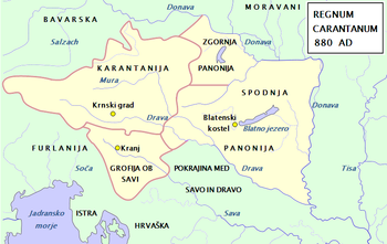
Europa um 526Karte der "Schwäbischen Lande" um 550 n. Chr.Europa um 560Marca VinedorumTribal Kingdom of Samo.The map of hypothecal principalities in the Eastern AlpsProbable territory of Karniola (not Krajnska) around year 800 AD.Carantania (Karantanija) at 800 ADMap of Western Balkans; c. 814 ADFrankenreich 481–814Europa 814Frankenreich 843Principality of Lower Pannonia, one of the earliest Slavic states, during Prince Pribina's reign (around 846 AD).Principality of Lower Pannonia, one of the earliest Slavic states, during Prince Pribina's reign (around 846 AD).Map of the Carolingian EmpireEuropa 870Europa nach 870Map of Regnum Carantanum.Lower Pannonia in IX. century ADLower Pannonia (Spodnja Panonija) during the reign of Kocelj (9th century)Regnum of Braslav 884/896Europa 850/900Slawen im 10. JahrhundertUngarn im 10. Jahrhundert.Karantanien 990Italien um 1000Italien und Illyrien 1084Zentraleuropa 919 bis 1125 (Ottonen und Salier)Ottonen und SalierGreat Carantania 952 bis 1182Ungarn 10. bis 12. Jahrhundert.Ungarn im 11. Jahrhundert.Ungarn im 13. Jahrhundert.