Diskussion:Taman (Halbinsel)
Versteckten Text hierher kopiert:
The peninsula was ruled by Scythians from ancient times. In the classical period it became part of the Bosporan kingdom; its inhabitants included Sarmatians, Greeks, Anatolian settlers from Pontus, and Jews. In the fourth century CE the area fell to the Huns; it was later the capital of Great Bulgaria and fell to the Khazars in the mid-seventh century. Following the breakup of the Khazar Khaganate in c. 969, the peninsula was part of a Khazar Jewish successor state under a ruler named David. By the late 980's it was largely in the possession of the Kievan Rus and the Russian Principality of Tumutarakan before falling to the Kipchaks c. 1100. The Mongols seized the area in 1239 and it became a possession of Genoa, along with Gazaria in Crimea, in 1419.
For most of the 1400's the peninsula was ruled on behalf of Gazaria by the Guizolfi (Ghisolfi) family, founded by the Genoese Jew Simeone de Guizolfi. The rulership of the region by Jewish consuls, commissioners or princes has sparked much debate over the extent to which Khazar Judaism survived in southern Russia during this period. Ultimately, the Taman peninsula was seized by the Khanate of Crimea in 1483 and by the Ottoman Empire in 1783. In 1791, during the Second Russo-Turkish War, it passed into the control of the Russian Empire.
For much of the succeeding century, the area was sparsely populated. The largest settlement was a Cossack town called Taman, succeeded by the port town of Temryuk in modern times. The peninsula contains small mud volcanoes and deposits of natural gas and petroleum.
Taman peninsula was occupied by the Nazis in 1942 and taken back by the Red Army in 1943. The story of the motion picture Cross of Iron revolves around conflicts that arise within the leadership of a Wehrmacht regiment during the German retreat from the Taman Peninsula.-->
NPOV - Beschissene Karte[Quelltext bearbeiten]
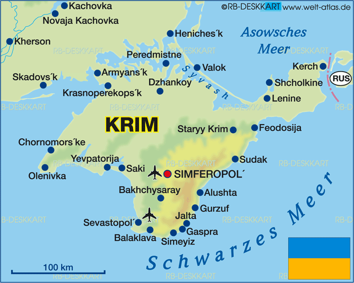
Die Karte ist ja wohl unter aller Sau - da hat jemand mit Photoshop manipuliert. Die Krim sieht auf der Karte wie verwachsen mit dem Festland aus, dabei ist da lauter Wasser dazwischen, es gibt nur ein, zwei schmale Übergänge. Vergleiche mit dieser geographisch korrekten Karte hier: https://www.welt-atlas.de/datenbank/karten/karte-1-461.gif -- Alexey Topol (Diskussion) 21:12, 2. Dez. 2015 (CET)
- In dem Ton überhaupt nicht. Ja, die Karte ist schlecht. Such eine bessere. -- j.budissin+/- 11:57, 3. Dez. 2015 (CET)
Asien?[Quelltext bearbeiten]
Ich weiss nicht, wo du deine geographischen Kenntnisse her hast, aber nördlich des Kaukasus ist es europäisch. Auch in der Wikipedia, für diese gibt es keine gesonderte geographische Definition! Ich werde den Unsinn jetzt zurücksetzten und wenn du den Unfug wieder einsetzten solltest, treffen wir uns auf der VM, wo du dich schön blamieren wirst. Danke! Berihert ♦ (Disk.) 13:58, 27. Apr. 2016 (CEST)
- Diese Karte zeigt den in der WP verwendeten Standard (bei Kategorisierung muss man sich eben zwischen ja und nein/hü und hott/Europa und Asien entscheiden). Deine plumpen Ad-hominem-Sprüche verbitte ich mir in diesem Zusammenhang. --Århus (Diskussion) 14:02, 27. Apr. 2016 (CEST)
- Ach weisst du, ob plump oder nicht ist mir inzwischen hier vollkommen egal. Ist aber nix persönliches. Berihert ♦ (Disk.) 14:03, 27. Apr. 2016 (CEST)
- Um das mal zu versachlichen: Nach der verbreitetsten Definition ist die Manytschniederung an dieser Stelle die Grenze zwischen Europa und Asien, demnach wäre die Taman-Halbinsel bereits in Asien. Es gibt auch die Kaukasus-Variante, nach der dann allerdings auch der Elbrus der höchste Berg Europas wäre. Mehr dazu unter Innereurasische Grenze. --j.budissin+/- 17:04, 27. Apr. 2016 (CEST)
- Ach weisst du, ob plump oder nicht ist mir inzwischen hier vollkommen egal. Ist aber nix persönliches. Berihert ♦ (Disk.) 14:03, 27. Apr. 2016 (CEST)